Note 05 · 10 min · Troodos · Mountains
The mountain problem: coverage in the Troodos.
The Troodos massif is the most interesting radio geography on the island — granite-and-gabbro to nineteen-fifty metres, forty mountain villages, deep valleys, line-of-sight shadows. A reading of how the networks reach it.

Nicosia · October 2025
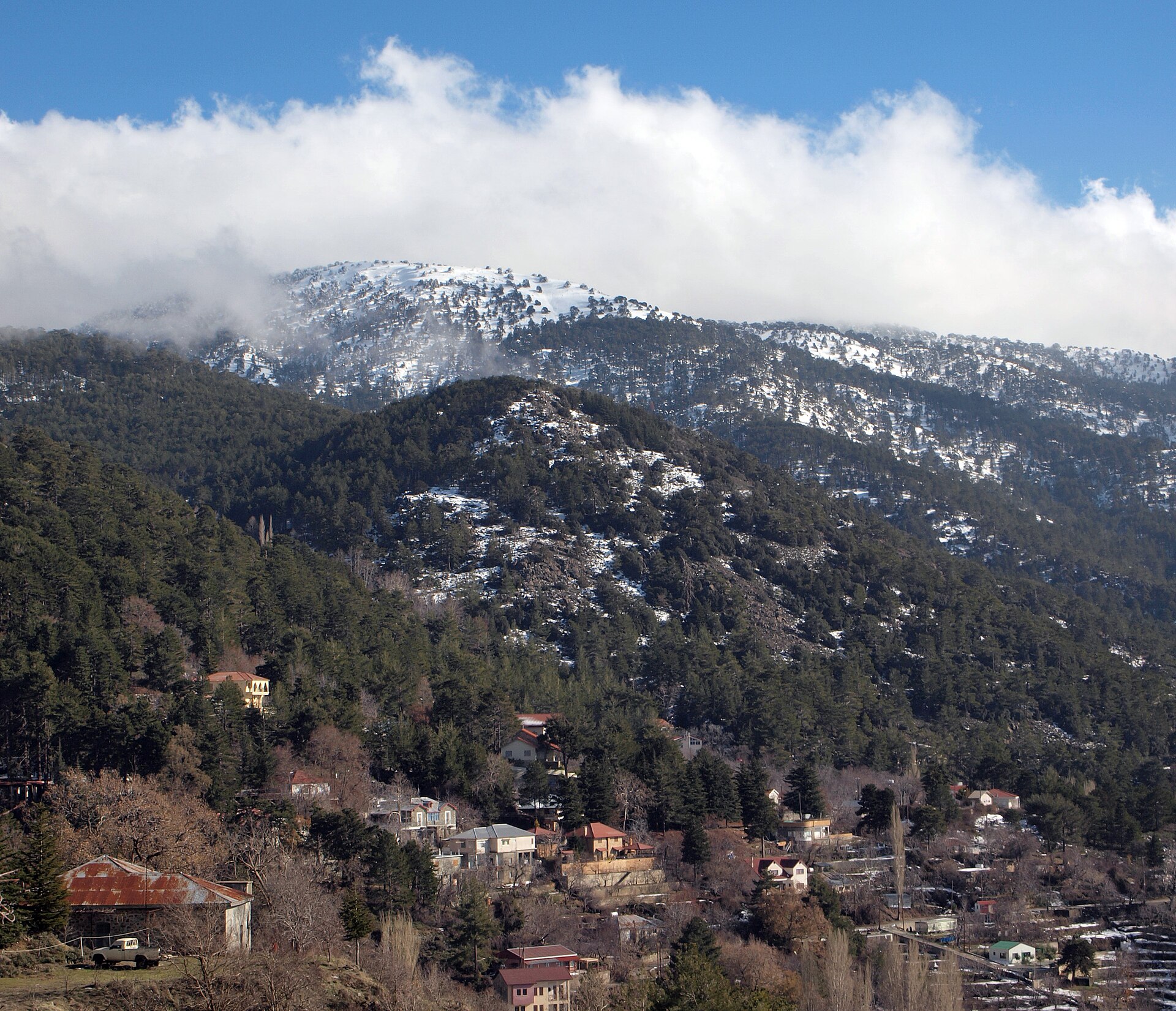
The Troodos massif occupies roughly the western and central third of Cyprus, rising from the coastal plain to Mount Olympus at one thousand nine hundred and fifty-two metres. It is a complete ophiolite — a rare exposure of upper-mantle and lower-crustal rocks that geologists have studied since the 1960s — and a magnificent and difficult radio environment. For a mobile-network planner, the Troodos is the most interesting geography on the island: line-of-sight shadows behind every ridge, deep valleys that swallow signal from above, forty mountain villages of fewer than five hundred residents each, and a road network that follows the contours rather than crossing them.
The summit installations
The summit of Mount Olympus has, since the British military period, carried a high-altitude transmitter site. The civilian use of the site — for FM radio, for digital terrestrial television, and for the Cyprus emergency-services network — predates the 1995 GSM launch, and the mobile operators have, since 1995, co-located their highest cell sites in the same general area. The summit cells use the 700 and 800 MHz bands almost exclusively; the longer wavelengths at those frequencies are necessary to reach the valley-bottom villages without being defeated by the intervening rock mass.
The summit site is, by the operators' published statements, the highest commercial cell on the island and one of the higher cells in the Eastern Mediterranean. The line-of-sight coverage from the summit reaches, on a clear day, to the Akrotiri peninsula on the south coast (approximately fifty kilometres) and to the Pomos cape on the north-west (approximately forty kilometres). The signal is, of course, only useful where a handset can actually hear it without intervening obstruction — which is most of the coastal plain and most of the western foothills, but very little of the deep valleys directly below the summit itself.
The village coverage problem
Forty Troodos villages — Pedoulas, Kalopanayiotis, Moutoullas, Prodromos, Platres, Kakopetria, and the smaller settlements of the Solea, the Marathasa, and the Pitsilia valleys — sit in deep valleys at elevations between five hundred and twelve hundred metres, with intervening ridges of three to seven hundred metres. The summit cell at Olympus does not reach most of these villages: the radio horizon is blocked by the nearer ridges. Each village therefore needs a dedicated local cell.
The economics of a single dedicated cell for a village of three hundred to five hundred residents are, in commercial terms, difficult. The capital and operating cost of a single macro-cell site is in the order of seventy to a hundred thousand euros per year, and the revenue from a small village population at average per-subscriber revenues does not, on its own, justify that cost. The Cyprus rural-coverage obligation — written into the operators' licences at successive renewals — requires the operators to maintain coverage in settlements above a defined size irrespective of the commercial return, and the village cells of the Troodos are largely an instance of that obligation.
The microwave hops
The backhaul to the Troodos village cells is, in the present network, a mixture of fibre and high-capacity microwave. The fibre reach into the mountains follows the principal road corridors — the Limassol–Platres–Olympus road, the Nicosia–Kakopetria–Olympus road, the Paphos–Pano Panayia–Statos road — and reaches most of the larger villages. The smaller villages, particularly those in the side valleys, are backhauled by 80 GHz point-to-point microwave links to the nearest fibre hand-off.
The microwave links operate at very high frequencies (the 70–80 GHz E-band) and offer multi-gigabit-per-second capacity over hop distances of typically three to eight kilometres. The hops are deployed in line-of-sight chains that follow the ridges — a hop from Olympus summit to a repeater on Kykkos hill, a second hop from Kykkos to a small repeater near Kambos, a third hop down to the village cell at Tsakistra. The chain operates at the cost of a few additional milliseconds of latency per hop, which is, for ordinary user traffic, imperceptible.
The road coverage
The road coverage in the Troodos is the third coverage problem. The mountain roads — the B8 from Limassol to Troodos, the B9 from Nicosia, the F622 from Paphos — wind through deep cuttings and across long stretches of forest, with line-of-sight to no nearby village. The operators have, over the years, added roadside cells at the principal switchbacks and at the rest stops, with the explicit aim of maintaining a usable 4G coverage along the principal mountain routes. The coverage is not continuous — there are gaps in the deeper cuttings and on the forest stretches — but it is, in 2026, substantially complete on the principal roads.
The Troodos is the part of the island where the network does its most patient work. Forty villages, eighty roadside cells, a hundred microwave hops, a dozen fibre branches. A signal map that is, in detail, a topographic map.
The seasonal variation
The Troodos has a distinct seasonal radio behaviour that is worth noting. In winter — particularly during the snow weeks of January and February — the foliage of the cedar and pine forests is partially shed and the radio propagation through the forest improves measurably (the empirical loss reduction is in the range of two to four decibels at 700 MHz, more at higher frequencies). In summer, the reverse: the dense canopy and the high humidity attenuate the signal. The operators' coverage maps are seasonal documents; the published versions are, by convention, the worst-case summer maps.
What the mountain tells you
Three things, in my reading.
First, mountain coverage is not, in the strict commercial sense, profitable, and the Cyprus rural-coverage obligation is the mechanism that holds the village cells in place. The obligation is, by international standards, well-designed: it is specific, it is enforced, and it has produced a rural coverage map that is materially better than that of several larger European countries with comparable mountain geographies.
Second, the propagation physics in the Troodos rewards the low bands. The 700 and 800 MHz bands are doing the heavy lifting; the 3.5 GHz 5G layer (note 03) is, in the mountains, essentially absent. The mid-2020s European policy debates about 6 GHz allocation will, in due course, change this — but for now the mountains are a 4G country.
Third, the Troodos is the place to see the network's geometry most clearly. On the coast, the cells are everywhere and the network is invisible. In the mountains, every cell, every hop, every repeater is doing visible work against a visible geography. It is, for an engineer, the most legible part of the island.
Researched from the operators' published rural-coverage maps (2020–2025), the Department of Electronic Communications coverage-obligation monitoring reports, and field measurements taken on a 4G/5G handset along the principal Troodos mountain roads between April and September 2025.